Nicolette Casey-Phillips:
I am live from the 2025 National Hurricane Conference, and I have the pleasure of speaking to Dr. Phil Klotzbach:. Did I pronounce that correct? Do you mind if I can ask you the origin of your last name?
Dr. Phil Klotzbach:
Yes, you did. It’s German.
Casey-Phillips:
Yeah, it’s German! I assumed, we assumed, great. Okay, let’s get into this. Your seasonal forecasts are widely used in emergency planning. How do you hope responders use them more effectively?
Klotzbach:
Yeah, so our seasonal forecasts are based on, effectively, a lot of historical data. So we look for, basically, precursor signals that kind of tip us off to whether the season is going to be above or below normal. And obviously the seasonal forecast, especially the one we just put out in early April historically has modest levels of skill. There’s just a lot of uncertainty this far out as to how busy the season is going to be. I mean, from a preparedness tool, I mean, in general, more active seasons do have more hurricane impacts, but we can’t say, obviously, at this lead time, how, you know, if a certain area is going to be impacted; so at this point we’re just saying, the season for 2025, we expect the season to have above-normal activity. So the odds of impacts are elevated, but in general, the odds of impacts for any one small area along the coastline are going to be low for any particular year. So I think it’s just important to kind of realize what seasonal forecasts can do and what seasonal forecasts cannot do. Nobody can tell this far in advance if you know a particular area is going to be impacted. And you can even go back to a season—for example, like 2020, we had 30 storms in the Atlantic, and yet Florida mostly got by pretty well off in a year that had 30 storms. Obviously, had we known and you told me in April we’re going to have 30 storms in 2020, I probably would have said it’s probably not gonna go great for Florida. So it just depends on, you know, kind of the individual storms and exactly kind of what’s steering them. That overall, obviously gives you how much overall the wave impacts you end up with.
Casey-Phillips:
Do you mind if I ask you what factors go into those predictions?
Klotzbach:
So typically, with our April forecast, we’re focusing on kind of what’s going on globally. So we focus on kind of the broad-scale things like El Nino, La Nina—kind of what, how that is trending—where El Nino is warmer water than normal in the eastern and central Tropical Pacific, that typically increases levels of vertical wind shear, which tear apart hurricanes in the Atlantic. So El Nino tends to be good for us, bad for the hurricane. La Nina basically has the opposite impact. La Nina is colder than normal water in the eastern and central Tropical Pacific. We also focus a lot on what’s going on in the Atlantic. Are the waters warmer than normal, colder than normal? Kind of, what the overall pressure patterns are like, what the wind patterns are like. And again, with April, there’s still quite a bit of uncertainty in kind of how things are going to play out. Once we get to June, July, and August, the forecast confidence generally goes up. We get a better idea of kind of how all these things are playing out. And right now, we focus a lot on things, even, say, in the middle latitudes, and how that will then impact the tropics. Once we get more to July and August, we focus a lot more in just on what’s going on, even especially just in the tropical Atlantic, especially, so. The predictors that we use kind of shrink from kind of using stuff globally, more towards more local scale predictors as we get closer to the peak of the season. And then once we get to August, we also issue forecasts every two weeks, where we try to look at activity over the next two weeks. And that goes more from like, okay, the basin looks busy to, here’s what the next two weeks of storm activity potentially could look like. And then we start getting more to, you know, there may be impacts, say, more in the Gulf or in the Caribbean or, looks busy, but everything’s going to stay out in the open ocean and probably not be particularly impactful for land. So that’s where we start to go from kind of seeing basin-wide activity to focusing in on particular areas that may be causing impacts.
Casey-Phillips:
Wow. Okay, thank you so much for that clarification. Probably should have started with this, but I’m kind of curious. How did you get to this point in your career? Can you give me a little bit of background?
Klotzbach:
Yeah, so I grew up in Massachusetts, and I’ve been obsessed with the weather since I was a little kid. And so we had a hurricane go through in 1985—Hurricane Gloria—which went through Connecticut but caused an impact in Massachusetts. And then we had Hurricane Bob in 1991 which came closer and made landfall in Rhode Island and caused more significant impacts. So I’ve always been obsessed with the weather, and hurricanes definitely had always been something I’ve been fascinated by. And so in 2000 I went to graduate school, and I’d done an undergraduate research project on seasonal hurricane prediction. So I applied to go to graduate school with Dr. Bill Gray. And so Bill, he accepted me, so I got to work with him for 15 years, and he taught me, obviously, a tremendous amount about hurricanes and prediction and all that stuff. So yeah, so I started working with him, and I’ve been working at CSU since that time.
Casey-Phillips:
Wow, that’s amazing. Have a lot to owe to him, huh?
Klotzbach:
Yes, yes. Nine years ago he passed away. Nine years ago today, she just messaged; I was texting with his daughter this morning about that. So, yes, yeah. So I definitely remember him. I remember him more than just on the day that he passed away. He was a giant in the field and just a giant human being in general. He was six foot four, six foot five. Very loud and had a huge presence about him. And just, yeah, just an all around, a great guy.
Casey-Phillips:
Amazing. Well, thank you for sharing that with me. Awesome. Okay, what would you say is the biggest misconception people have about hurricane forecasts?
Klotzbach:
Yeah, so especially on the seasonal time scale, I think there’s a misconception that you can tell people where the storms are going to go, and we’re just, like, holding back because we don’t, but we can’t. There’s nothing we can say this far in advance about where storms are going to track. And, you know, one storm may track west, one storm may recur, it’s not like there are one set of conditions that are going to push all the storms the same direction all season long. There’s some years where storms tend to track a similar way, but there’s other years where one storm goes this way, one storm goes that way, and they just kind of go their own way. So I think what we kind of emphasize from a preparedness perspective, especially for coastal residents, is you need to be prepared the same for every hurricane season, because it just takes, you know, that one storm to make it a busy season for you. But if you do look also at seasonal forecasts, and say, you look at 10 years where we forecast a lot of storms versus 10 years where we forecast fewer storms, you do see differences in the numbers of landfalls, in general, when you have busier seasons, you tend to have more landfalls. Doesn’t work out every year. You can have a year like 2010 with 12 hurricanes, where not one hits the U.S. We got a great string of luck that year. But there’s years like 1983 where we only had four storms, one major hurricane for six hours, and that was Alicia, which caused a lot of damage in Texas. But in general, if you have years like 2020, 2004, 2005 that are very busy, you tend to, overall, see years that are more activity in the basin, tend to have more landfall activity both in the United States, but also in adjacent countries as well.
Casey-Phillips:
Okay, wow, awesome. That’s so interesting. I think the general public definitely don’t realize the nuances of forecasting or the forecasting process.
Klotzbach:
Correct, yes. I think people think that you can forecast where storms are going to track in April. It’s not just mid-latitude. Weather is very changeable. And you know, if you say looking at kind of what steers the storms, often, we call, like the Bermuda high system, which is a subtropical high-pressure system that’s semi-permanent, but it moves around a lot, dated week to week, month to month, like it doesn’t just sit in one spot and never move. If you watch a model, it moves around a lot. And so it’s where it sets up relative to where the storm is on that particular day that matters. And maybe it would have gone into North Carolina every day, but that one day, if the storm happens to be there and it recurs. So there’s that kind of stuff that definitely makes it move around a lot. So the mid-latitude weather patterns are much more changeable than the weather in the tropics, and that’s one of the reasons why we generally can get reasonably good predictions in the tropics, because the weather tends to be fairly persistent, but the steering is a lot more volatile because it’s mid-latitude weather. And I can tell you, having lived in Colorado for a long time, that the weather is very volatile in Colorado. For example, Saturday it was 86 degrees, a record high for the day, and early Monday morning it was snow.
Casey-Phillips:
The craziness of that, coming from Texas as well, because I’m out of Texas with the Texas Division of Emergency Management, and I swear that, just the extremes.
Klotzbach:
Correct, yeah, yes. Especially inland in Texas, the weather can change very, very quickly.
Casey-Phillips:
You bring a sweater, you have a tank top, you have to be prepared for anything.
Klotzbach:
Exactly, yes. I always say, you never put your warm clothes away or put your cold clothes away, because yes, you can use a jacket and shorts within an hour of each other.
Casey-Phillips:
Yes, I didn’t realize it was like that in Colorado.
Klotzbach:
Yes, we’re very, very far away from an ocean. So the weather is very, very volatile.
Casey-Phillips:
Okay, that makes sense now. Okay, well, thank you. That’s a great takeaway. All right, let’s see, now, your two-week hurricane outlooks are so unique. Now, what led you to create that and how have agencies responded to using them?
Klotzbach:
Yeah, so during the hurricane season or up to August, we do these seasonal predictions where we try to predict overall activity for the season. But we know you can have a year, for example, 2024 is a great example. 2024 ended up a hyperactive hurricane season, but we had five weeks during the middle of the season where almost nothing happened, where normally you expect a ton of activity between, like, the middle part of August and middle part of September, and we had almost nothing. And so there’s things that can drive activity on shorter-term time scales that can cause busy periods during a quiet season or a quiet period during a busy season. So we started doing that, I believe, back in 2006, trying to kind of pinpoint when, during the season, you may have these up and down periods. Now some seasons are just busy throughout. But even, for example, 2020, we had 30 storms. A lot of part of September was fairly quiet, and then just picked right back up. But 2024, I think, is a great example of a year that ended up hyperactive, but had very distinct periods where it was got extremely quiet, and then another periods that were really, really busy. So we do that, and we’ve been doing that since 2006. NOAA’s Client Prediction Center also does a Week Two and Week Three tropical cyclone forecast. They actually do it globally. And they do that outlook every Monday.
Casey-Phillips:
I love that. Filling the gap between the long-term season outlooks versus just real-time tracking.
Klotzbach:
Correct, yeah. So the National Hurricane Center goes out seven days, and then the Kaya Prediction Center does weeks two and three, and then there’s the seasonal outlook. So it’s kind of like a bridge between and so obviously individual storms, you can be like, Hey, here’s a system that we think is going to form in, you know, three to five days or something like that. But then as you get further out, it’s like, okay, maybe this region looks conducive, but it’s something that I can tell you, 25 years ago, we just didn’t have the ability to do. There just wasn’t the model, the technology, really, and the model ability. But now you can look and see, you know, and it’s not perfect, certainly, there’s uncertainty, but the models will give us some clues. And there’s also kind of large scale atmosphere ocean, especially large scale atmospheric conditions, that will kind of modulate activity on that two to three week time scale that you can have some predictability on. So, there’s certainly uncertainty in that, but you can generally see, for example, mid September of last year, we had been extremely quiet, but you could start to see the models were starting to get really aggressive, that there was a whole lot of activity that was about to develop and so and you could even see, like, the science of something kind of gnarly coming out of the Caribbean, which was what became Helene.
Casey-Phillips:
Oh, wow. I like that. That’s a great way to put it. Yeah. Okay, awesome. Now, as a speaker at the conference, what do you hope attendees walk away with from your session?
Klotzbach:
Yeah, so we did. I’ve done a couple of sessions, so we’re doing one on Thursday, basically, we’ll be discussing the outlook for the season. But we also did a session on Monday where I co-presented with colleagues from University of Texas A&M Corpus Christi and the Weather Service in New Orleans on the 2005 hurricane season, so discussing, kind of the meteorology of the season, and then focusing, because obviously we’re here in New Orleans discussing the meteorology behind Hurricane Katrina. Also kind of how, you know, tools that we had in 2005 and then what we have now, and obviously, you know, technology has continued to improve, the model forecasts have gotten better, but also just have been basically developments in social science that have helped, you know, improving with the messaging. But obviously messaging now is very different than 2005. 2005 social media—there was some, but not very much, you know. So just how people digest media now versus 20 years ago is quite a bit different. So how do you message to, you know, audiences today versus 20 years ago? And even, I can tell you, even like messaging with the seasonal forecasts. You know, it’s used to be, I mean, back in the day, Dr. Gray, we used to like mail physical copies of the forecast to people. That was the way we did the forecast. But then, obviously, you had the web, which is great, but then obviously, now a lot of it is, okay, people will go to websites, but most of it is driven now by, you post stuff on social to kind of get people, okay, here’s the forecast, and you try to do like very bite-sized snippets. It’s ever-changing. We have a pretty extensive, like the forecast document itself is like 40 pages long with this huge discussion, but most people probably are never going to read that. So we also have just like little snippets of trying to kind of come up with different ways to get people to kind of hit the high points of the forecast. So we have a variety of different kind of tools that we use. And we are—in our research group at Colorado State, we have several students that are from Puerto Rico, so we actually translate the press release into Spanish as well. We don’t ask them to translate the 40-page forecast, but the press release. The 40-page forecast would be a, would be a rough undertaking, but the press release into Spanish, so trying to accommodate that as well.
Casey-Phillips:
That’s amazing. That’s important. But also, what are the challenges you see with that new way of communicating these updates to our communities?
Klotzbach:
I mean, I think the challenge is, of course, it’s, it’s, there’s, it’s a lot easier for the messaging to get kind of corrupted along the way. And you can’t, you know, it’s like herding cats like you can’t, I can’t look at, I post stuff on social and then I just let it go. Like, I don’t necessarily—but people can misinterpret kind of what they want, and they can, and it also gets hard that just, you know, there’s a lot of people with voices, you know, on social media, anybody can post anything they want, and they may not have the knowledge. And I guess someone, they said, last year, somebody posted a side image from 2020 with Marco and Laura in last year. And so this is the current gulf and they got paid like 100,000 for it. Completely wrong, like it’s a satellite from four years earlier, but they made 100 grand on it. They don’t care. It’s like, but people click on it, because they’re not going to necessarily know. So it’s, it’s, it’s how, how we can message stuff. Because it used to just be like, there was, like, you know, the Hurricane Center says this, and that was the answer. And but now, obviously, everybody who wants to, you can get access to all the models. You can look at everything yourself. And so it gets the voices that are, you know, people are paying attention to, may not be the voices actually that kind of know what’s going on. So it’s trying to, kind of, you know, how do you handle that?
Casey-Phillips:
Absolutely. I was speaking to Jim Wilson, Jim or John Wilson? John Wilson, for some reason always get Jim and John mixed up. I don’t know. Anyways, I was speaking to him and Fugate the day before, and they mentioned something in relation to messaging, and it was, you want to either have something that affirms what you feel is correct or something that challenges it. And so many people, by human nature, want to lean towards what affirms what they already believe in. So when it comes to communicating the message that y’all are trying to give to the community on these updates, I could see how I can get kind of messy, and if things are going viral, or people are getting paid so much, I’m gonna trust that. Yeah, whatever they say.
Klotzbach:
And it also gets challenging, too, because especially with, you know, with social, especially because I’ve used Twitter or X as my primary form of communication. It used to be that the people that were verified had to like, we’re kind of considered, like trusted sources and stuff. And you didn’t, you couldn’t—basically like someone, effectively, like Twitter staff had to verify you. And, you know, it took a long time to get it, and you couldn’t, like request it, they just did it. But now you just pay for it. So I’m not verified anymore, and now people that pay are, because it’s the people that pay. So people that pay, I mean any Schmo can pay and then just their voices are the ones that get amplified, and they know diddly squat. And that’s the challenge. Again, I don’t pay that much attention, because I just have other things I need to do with my life. But, you know, I’ll get reporters like, Hey, so and so says this. I’m like, I never heard of this person. And people just spout whatever they want. And so there’s no way to really, you know. So it is, it is challenging because, like you said, you can find, you know, even just like with news, like now, there’s, there’s, if you want to, you can view news from a very specific lens. Whereas it used to be like, okay, you watched the TV news and it was more just kind of like—and the TV news tend to be kind of more like, not super biased. But now it’s like, if you want, if you want views from one person or views from another, you can, you can easily look at all the news and find things that will definitely affirm what you want to believe. So it makes it, makes it kind of challenging. And I think obviously it’s just gonna be the same in weather, if you want to view a certain thing, you can, you know. So it’s, that I think is always going to be a challenge, but you just, kind of, you kind of just do the best you can.
Casey-Phillips:
You kind of do the best you can. Yeah, it’s going to be the title of this podcast.
Klotzbach:
That’s right. Pretty much.
Casey-Phillips:
We do the best we can. Okay, now, when you’re presenting to non-scientists at events like this, how do you approach making the information accessible without oversimplifying it?
Klotzbach:
Yeah, that’s a challenge, because I think sometimes people look and like, Oh, you just look at the Pacific water temperatures and Atlantic water temperatures, and that’s your forecast. So it takes 10 minutes, and you should, you know. But there’s a lot more that goes into it, so we try to—so, you know, obviously, with, with, with the group here, like people here, obviously are in the hurricane world, so they, they have a pretty good knowledge of what hurricanes are. So, you know, but there certainly are different kind of levels of kind of geekiness that I’ll talk to, depending on the audience that I’m talking with. So this audience, I mean, most of the people here, are familiar with seasonal forecasts. So we can dive somewhat into, okay, here’s what the various models are saying, and here’s kind of some of the stuff that we’re looking at. But, yeah, I mean, obviously you do what you have to be, you know, mindful of the audience that you’re conveying it to, that not everybody is, you know, not everyone here is a meteorologist that’s gonna be staring at the charts that I’m staring at every day. But they also do, you know, obviously you want to kind of, it’s all, it is a bit of a challenge to be, but you want to not oversimplify, like you said. But also, you know, we want people to at least somewhat get the nuggets that you’re trying to convey. But kind of the way that we do it with, just in general, is we try to have kind of different levels of kind of complexity when we do our discussion. So everything from just like, you know, a press release, which is pretty simple and straightforward, all the way to like the forecast document itself. Or, if you really want to get into all the nuts and bolts of all the different models we use and the different statistical approaches and the different thing…distributions we fit stuff to, you can really get into the geekiness, if you want to.
Casey-Phillips:
I love that. That’s fun. No, that’s such a skill. You know, translating data in a way that really sticks with people, your audience, when it comes to these presentations.
Klotzbach:
Yeah, I try, the general thing is, it’s like, I try to just be fired up and excited, enthusiastic, and that usually, at least we’re like, well, at least he likes what he does. I mean, I’ve forgotten what he said, but at least he liked it.
Casey-Phillips:
I don’t think you flinch one second here. You can tell that this is second nature. This is your language, and you’re very passionate about that.
Klotzbach:
I try to get fired up about hurricanes.
Casey-Phillips:
Yes, I love that. I appreciate that energy. Now to really wrap things up, because I know you’re a busy man, I just want to ask you, now, if someone was entering the field that you’re familiar with, what piece of advice would you give them?
Klotzbach:
Yeah, so, I mean, I think, I think it, I mean, it depends on kind of, like, what field you’re looking at. So if you’re looking at straight up, like meteorology, you know, prediction, and, you know, I would say, especially, like, definitely, the more, the more programming skills you can get, the better. But it’s definitely becoming a lot more, even than when I started in the field, like being—obviously, there’s a lot of tools now, especially with AI, you can, it can write a lot of the code for you, which is nice, but there’s certainly, you know, technology is obviously going to be a huge driver of things. I think, really, though, the key, especially as we get more and more technology and the forecasts get better and better—is going to be really key, is science communication. Because at the end of the day, we need people that can communicate what they’re studying. Because you can be, you can be doing amazing work, and if you can’t communicate it with people, it’s, it’s hard. So I think really, the key is focusing on communication. And, yeah, I mean, and I think even especially like, if you’re going into emergency management, there’s a lot more emergency management now that has meteorology backgrounds, which is very valuable, I think, just given that a lot of emergencies are at least somewhat related to—not everything is weather-related in emergency management, but a lot of it is. So it definitely is, it’s, it’s, it’s, you know, it’s important to have. And I think also, you know, with meteorology, especially like, there’s, there’s obviously jobs in government, but there’s also, and you know, you can do like broadcast meteorology, but there’s obviously a lot of private companies that also employ meteorologists. Everything from, you know, there’s private weather forecasting companies to, you know, a lot of major corporations. You involve meteorologists, climate forecasters for various commodities, all the way to insurance. There’s all these different areas that are, that have meteorologists. So I think it’s, you know, you can, you can, kind of, if there’s a certain area you want to work in, often you know, they will actually be using, they will have meteorologists on their staff.
Casey-Phillips:
Oh, that’s wonderful. Thank you so much for sharing all of this with me, and I hope, you know, we attend next year, and we can continue this discussion, and I can attend your, you know, predictions for 2026!
Klotzbach:
Sounds good.
Casey-Phillips:
Something like that. So I appreciate talking to you, and you have a great day.
Klotzbach:
Thank you. You too.
Casey-Phillips:
Thank you. Awesome.
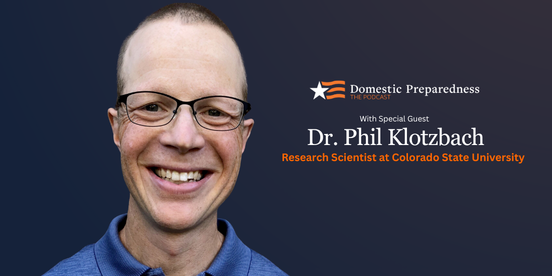
Philip Klotzbach
Philip Klotzbach, Ph.D., is a research scientist in the Department of Atmospheric Science at Colorado State University. He was co-author on the Atlantic basin hurricane forecasts with Dr. William Gray through 2005 and became the first author on seasonal hurricane forecasts in 2006. Dr. Klotzbach developed the two-week forecasts currently being issued during peak months of the hurricane season between August and October. Dr. Klotzbach has published over two dozen articles in peer-reviewed journals, and he is frequently consulted by the media and quoted regularly on the Weather Channel, in Forbes, the New York Times, USA Today, and the Wall Street Journal. Dr. Klotzbach holds a B.S. in geography from Bridgewater State College and an M.S. and Ph.D. in atmospheric science from Colorado State University.
- This author does not have any more posts.